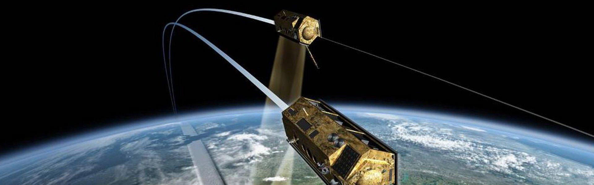
What is happening on Earth? How are our forests doing? And what are the consequences of climate change? Finding answers to these pressing questions requires an accurate picture of our planet. Optical cameras were used for this purpose as early as the 1970s. Radar systems have existed in space since 1979, and their technology has been constantly refined. In 2000, the principle of stereo radar was implemented for the first time on a NASA space shuttle. From this arose the idea for the TerraSAR-X high-resolution radar system, which the German Aerospace Center (DLR), partnering with Airbus, realized in 2007. Since 2010, this first German radar satellite has had a twin: as TanDEM-X, the pair flies around the Earth – sometimes just 120 meters from each other – providing a 3D view of the entire globe. The satellites each see the landscape below them from a slightly different angle. Sensors scan the surface using microwaves.
TanDEM-X delivers 3D model of Earth
The data provided by TanDEM-X can also be helpful in detecting variations in glaciers caused by climate change, tracking down illegal clearing of rainforests, or steering road traffic smoothly. The satellite duo was developed by three DLR researchers: Prof. Dr. Alberto Moreira, Dr. Gerhard Krieger, and Dr. Manfred Zink, who were nominated for the 2012 German Future Prize for their work.
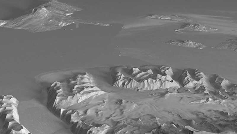
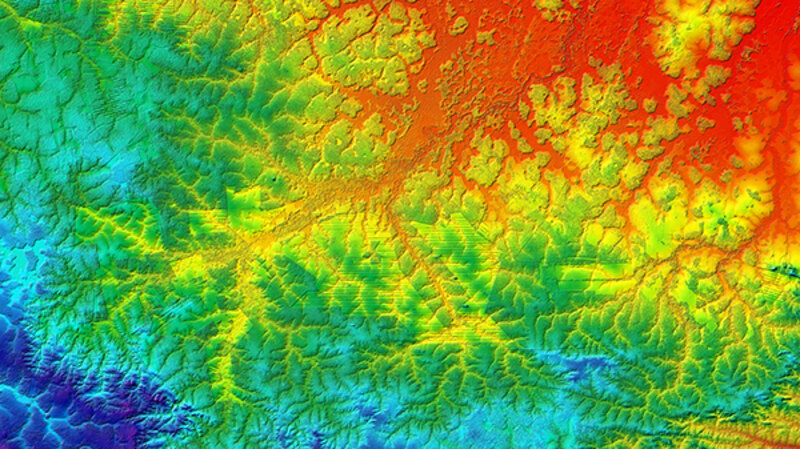
In 2018, the DLR used measurements from TanDEM-X to publish a map covering the entire land surface of the Earth – more than 148 million square kilometers. According to the DLR, the map records heights with an accuracy of one meter.
(Images and video: German Aerospace Center, DLR)